My Corner Online
Katy Trail State Park, Rocheport and Davisdale Conservation Area
We took our electric bikes to the Katy Trail at Rocheport, Boone County, Missouri (Katy Trail) and went a little bit one way towards New Franklin (west) and a little bit the other way towards McBaine (east), and then returned to Rocheport. We did not go the complete distance to either stop, but it is 9.9 miles to New Franklin and 8.8 miles to McBaine. We road a total of about 18 miles (or 9 miles of the trail because we went there and back). When we traveled west, we turned around after we reached the Davisdale Conservation Are which is in Howard County, and then also went back late in the day to find that same Conservation Area by vehicle, as you can see at the end of the above video. One could park where we did at the Conservation Area and do another section of the trail out and back. In fact, I think the Katy Tunnel is also in Howard County because Rocheport is so close to the boundary being barely in Boone County.
We stayed at a brand new AirBNB just a block or so from the train depot. We did drive around and check out the quaint town a bit and I did go in a few other places. They had a special event that evening, a wine walk, that we did not attend as we just did not have the time or the money. I think another day here though and we could have spent more time exploring the town.
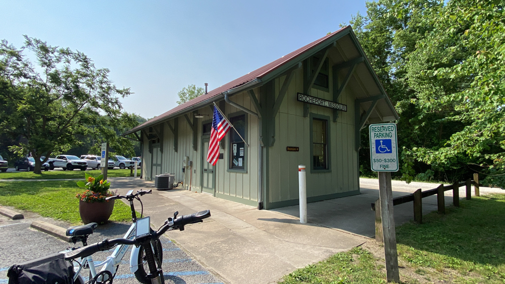
At the train depot in Rocheport is the her Cafe and Bike Shop which we at lunch at after we returned and put our bikes up in the AirBNB. We were able to eat outside with the dogs. You can see the restaurant at the end of the above video.
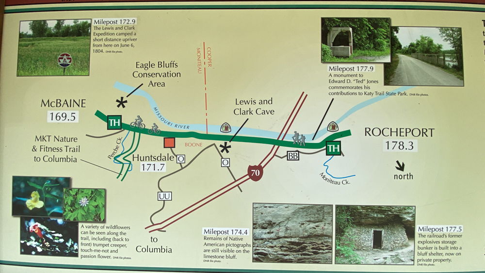
This is the trail to McBaine and you can see all of the fun things along the way as indicated by the mile markers around the edge of the map. We were constantly stopping to see all of the fun things, which you can see in the above video.
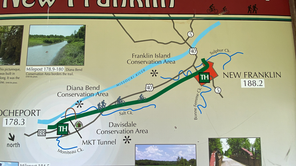
This is the map to New Franklin and as you can see we only went as far as Davisdale going west which is not very far (although it felt far to us!).
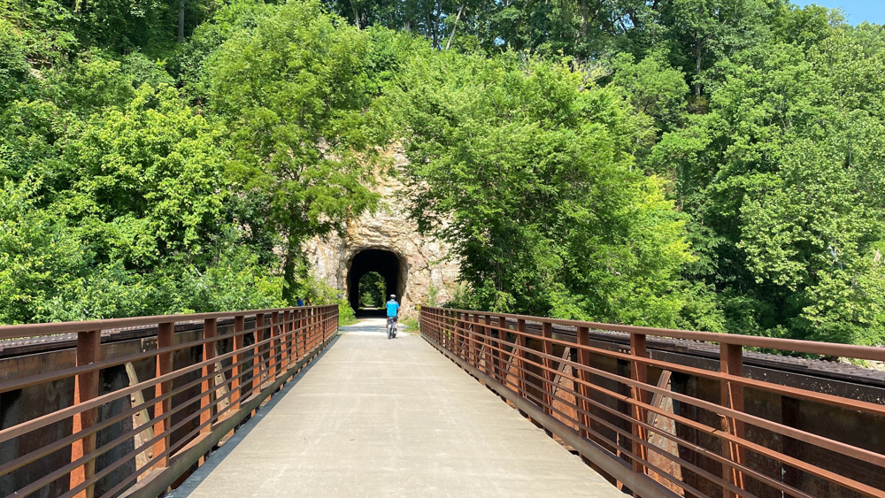
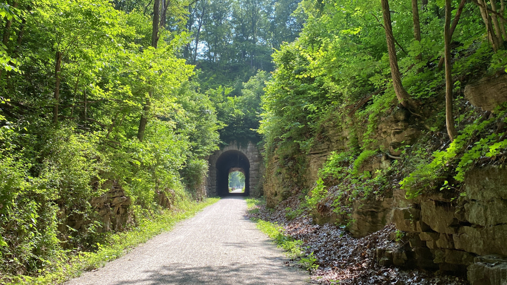
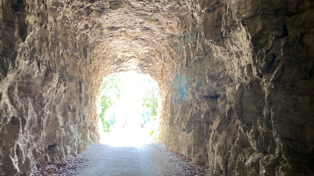
This is crossing the Monteau Creek as we are approaching the Katy Trail Tunnel.
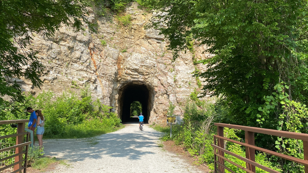
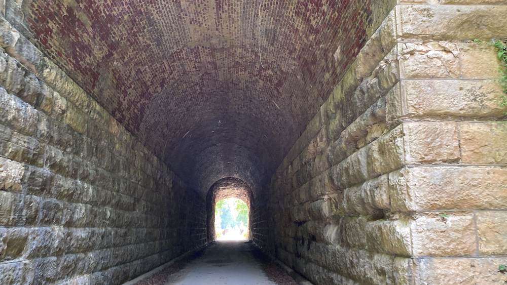
The turn to the left in this photo is to the Diana Bend Conservation Area. We decided not to go as we have limited battery power on our bikes. You can see how majestic the MKT tunnel entrance though! MKT stands for "Missouri, Kansas and Texas Railway Company" (MK&T), which is informally known as the Katy because of the final two letters. The tunnel is 243 feet long.
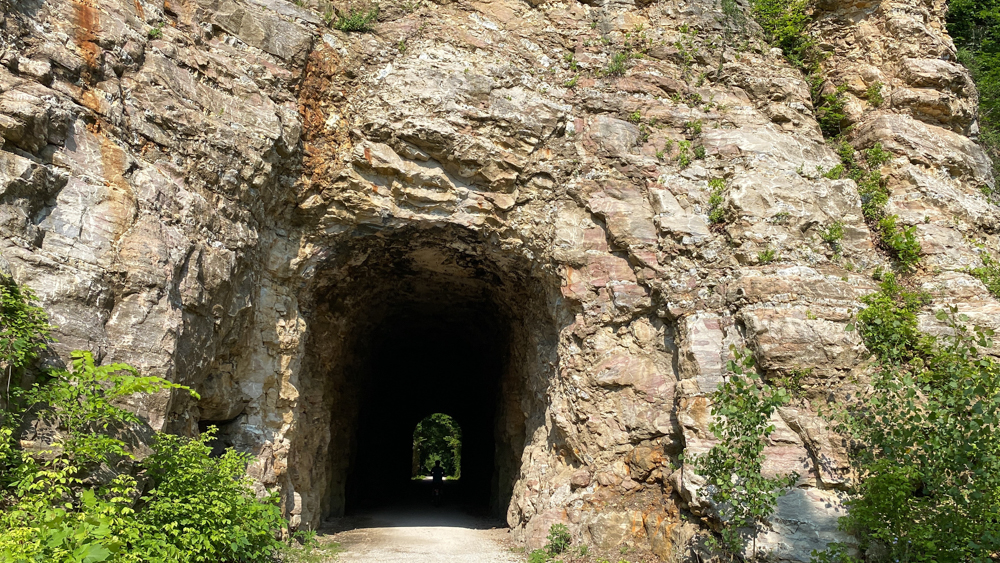
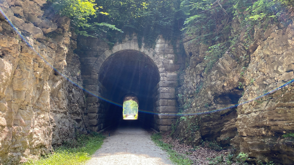
One of the things I loved about this tunnel is that it has changing textures. The ceiling is one texture and the walls have these stone blocks on one side and stacked rocks on the other.
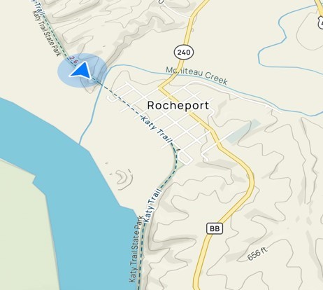
I took this screen shot to show how close the tunnel is to Rocheport.
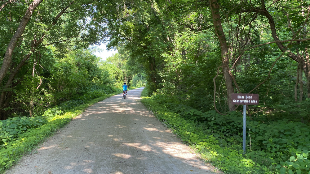
As we continued on the trail we came to a sign to let us know we were in the Diana Bend Conservation Area, so technically we did not have to turn to be within its boundaries. We were there! It borders the trail from 178.9 to 180.
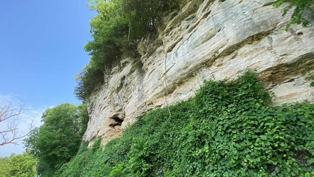
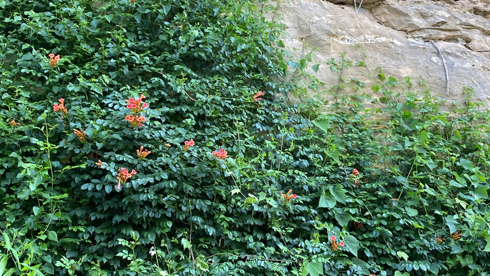
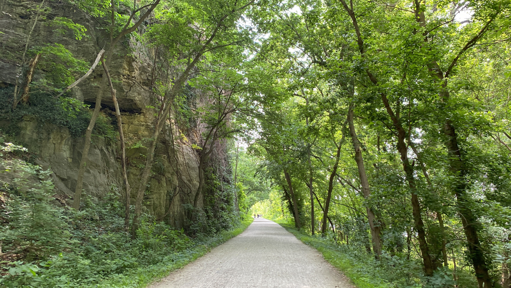
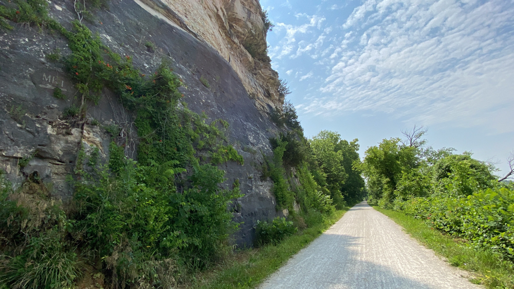
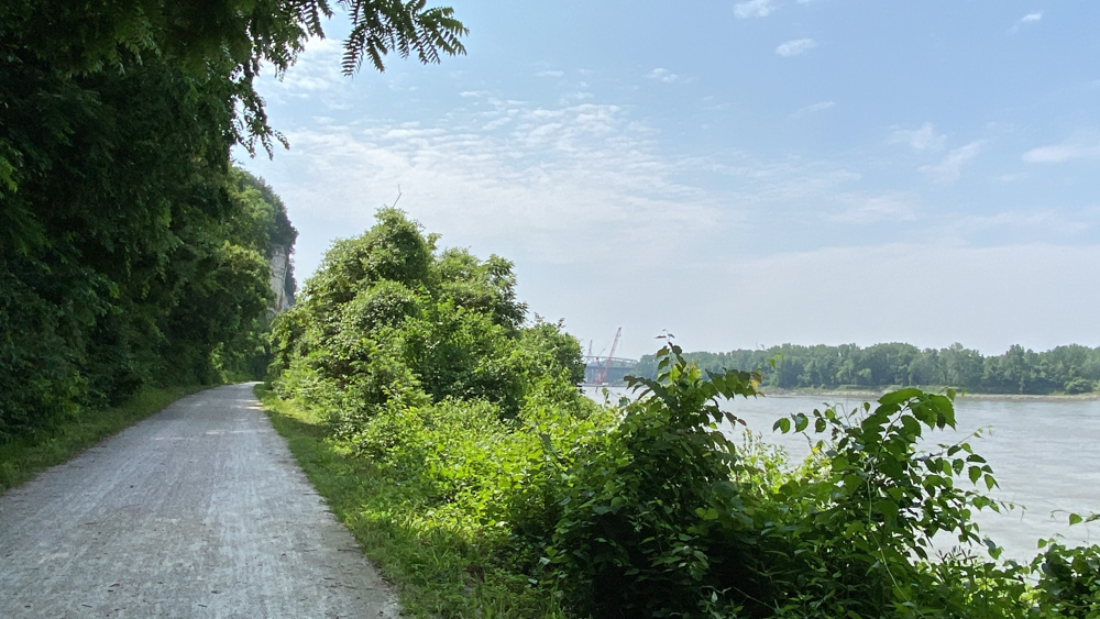
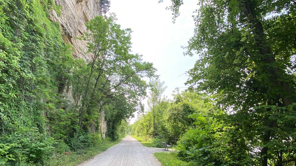
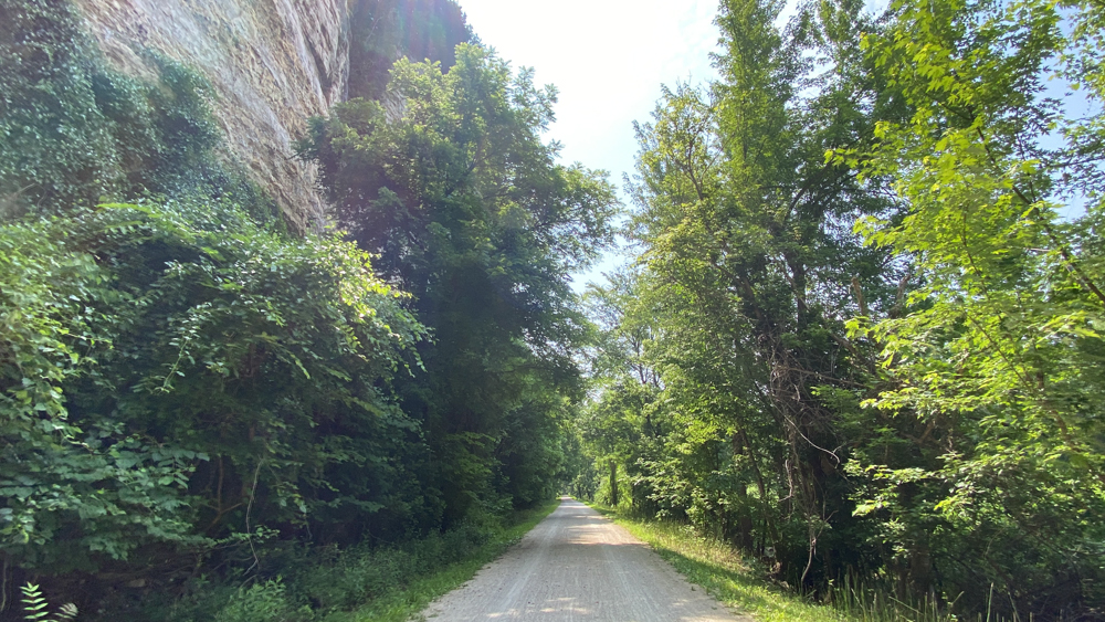
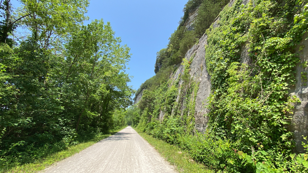
Like everyone, the extremely tall bluffs along this section of the Katy Trail are a wonder to behold. I also enjoyed the orange trumpet vine that was growing up the bluff. Even though I am aware it is an invasive plant that is undesirable, I just love flowers and so found some joy regardless.
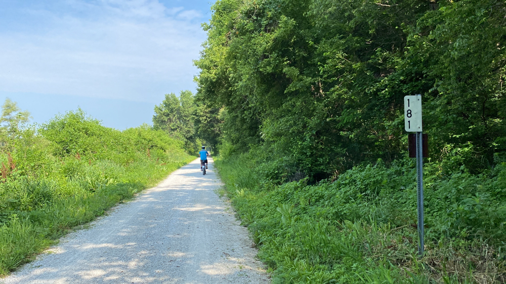
There are mile markers along the trail which do help when you are trying to find certain fun things along the trail. The maps give fun things to find and there are also helps on the internet with mileage related to these markers. Rocheport is at mile marker 178.3, so going west towards New Franklin (at 188.2), the numbers go up. Boonville is 191.8. Going east towards McBaine (at 169.5), the numbers go down.
The tunnel is at 178.9.
Davisdale is at 182.1.
We did not go this far on the trail, but for those planning a trip, at 184.5 is the town of Pearsons where you will see an old clay-tile grain elevator.
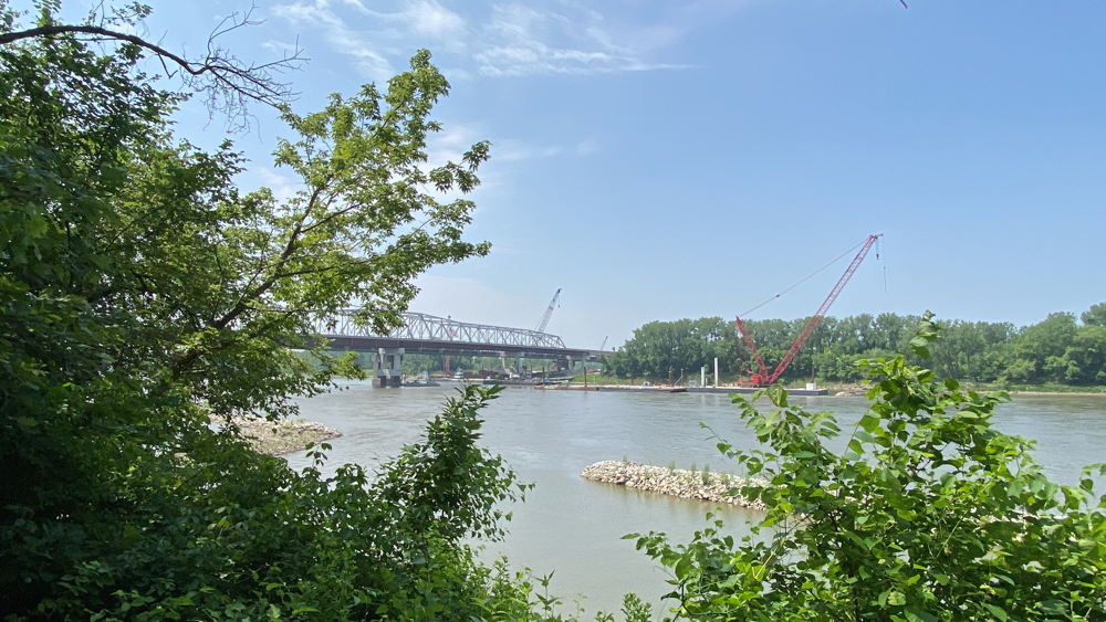
At 187.8 is the Bonne Femme Creek where Meriwether Lewis and William Clark camped at the old mouth of the creek on June 7, 1804, to paddle partway up the Bonne Femme. You will see the 150 foot long bridge built in 1897 at this location.
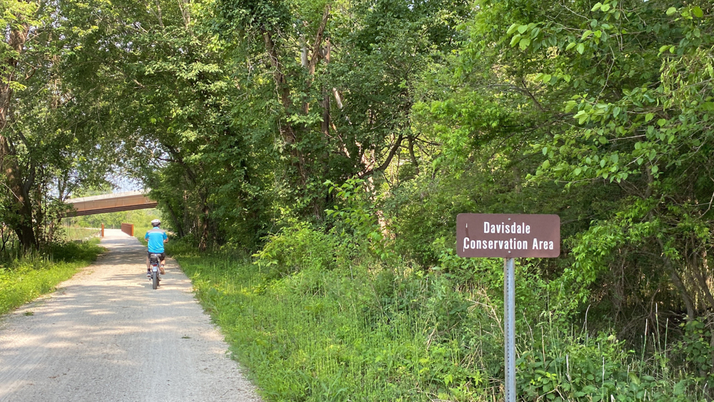
Since I have a goal to visit every county in Missouri for my website purposes, I wanted to be sure to reach the Davisdale Conservation Area which is in Howard County. We actually later in the day drove through Howard County traveling down Highway 40 to Boonville and Katy Bridge, which happens to cross over the Missouri River south into Cooper County! We even drove over the Highway 40 bridge that we were below while on the trail. At the end of the above video, you can see we stop at the parking lot of the Davisdale Conservation Area.
This is a bridge over Salt Creek.
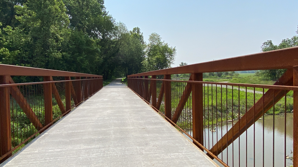
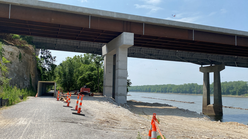
While we were under the Highway 40 bridge, as you can see in the video, we were taken aback by the numerous barn swallow nests and birds under the bridge. A lot of people drive over that bridge every day and have no knowledge of the birds underneath them.
Another tidbit is that at this location is a road that takes you to Diana Bend Conservation area too!
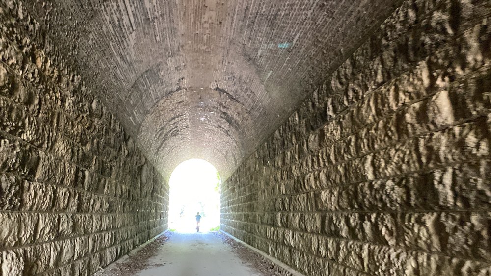
We turned around at the bridge and went back and through the tunnel again. This tunnel was used from 1893 to 1986 for the Kansas and Texas Railroad line.
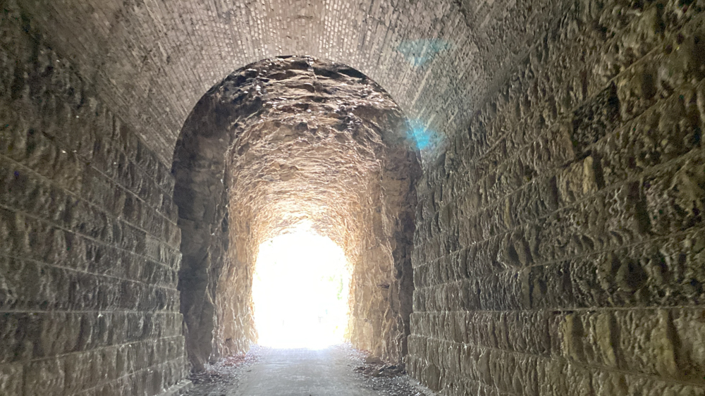
This image shows well where the types of rocks change. I have no idea why they are different. It is as if one section is older than the other.
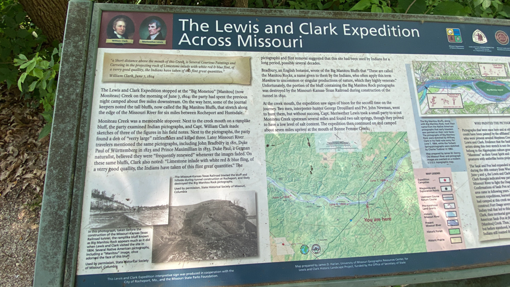
Right outside the tunnel is an information sign, which you will find others along the trail, all about the Lewis and Clark Expedition. Since Lewis and Clark started their journey west traveling down the Missouri River, until it came to an end and they realized the Missouri River did not go all the way west and had to rethink their plan to cross by land rather than water, it is natural that the Katy Trail which also follows the river contains locations in the history of Lewis and Clark. There is a list of the various dates and locations where Lewis and Clark stopped to explore, which is kind of cool.
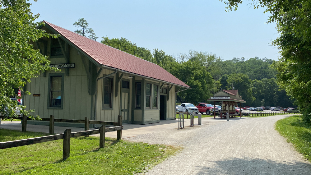
We passed the Rocheport station which is where we started and continued on.
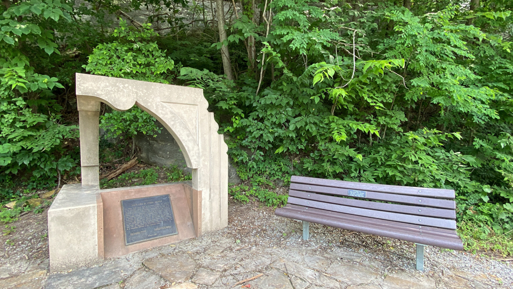
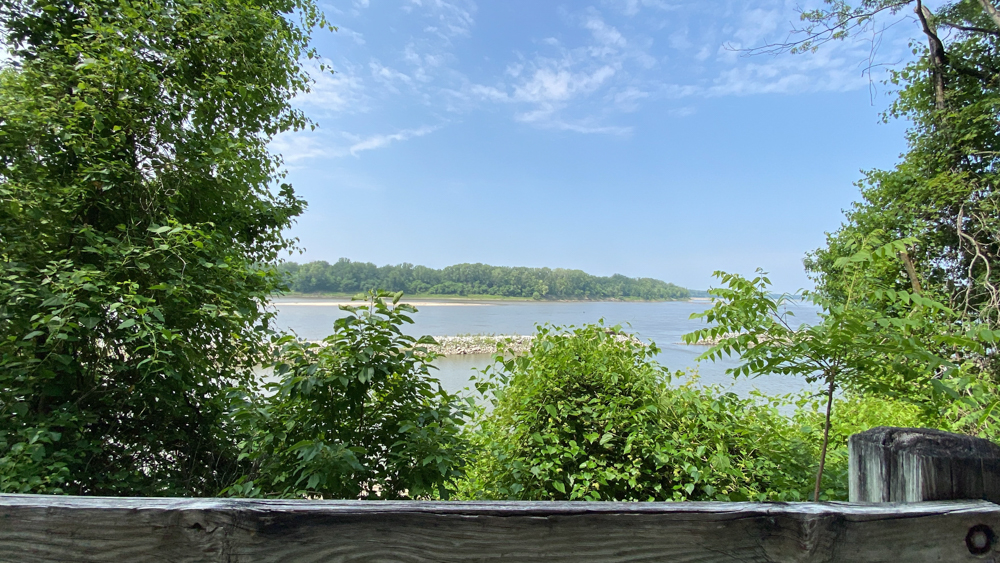
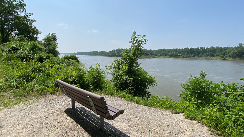
At 177.9 is the Edward D. "Ted" Jones commemorative plaque, art, and bench. This is a good place to stop and look out at the river, as in the below photograph.
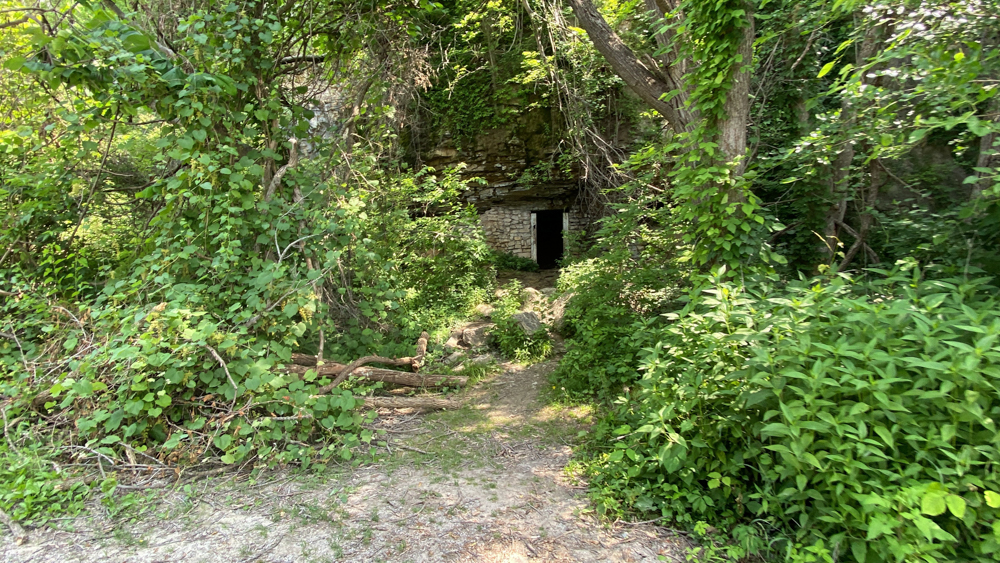
At 177.5 is the railroad's former explosive's storage bunker which is built into a bluff shelter. We parked our bikes and took a walk to peek inside.
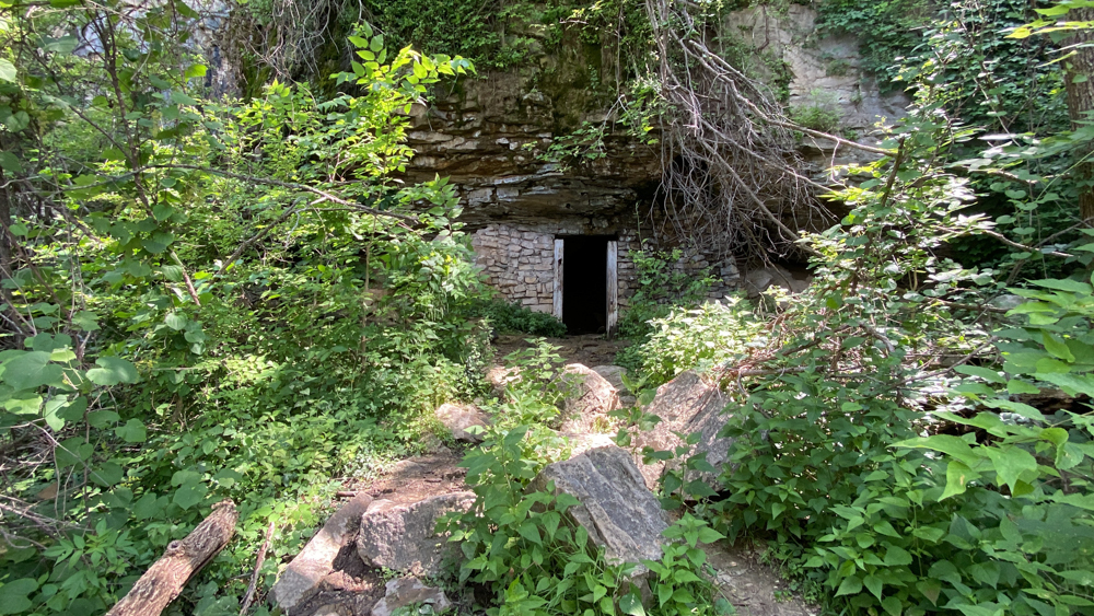
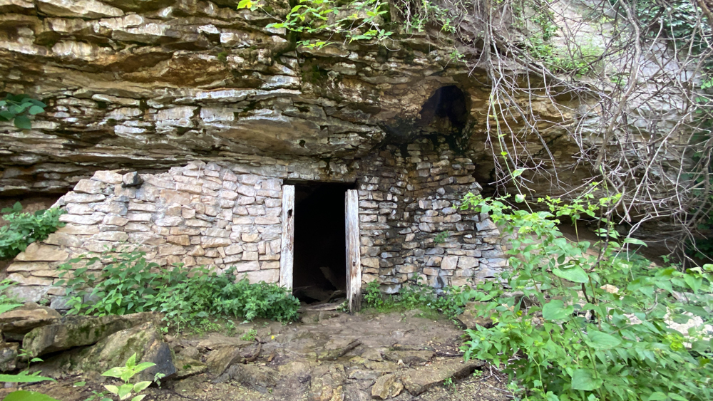
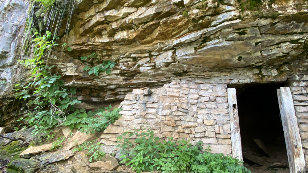
There was a small waterfall with that beautiful sound I love to hear to the left of the doorway.
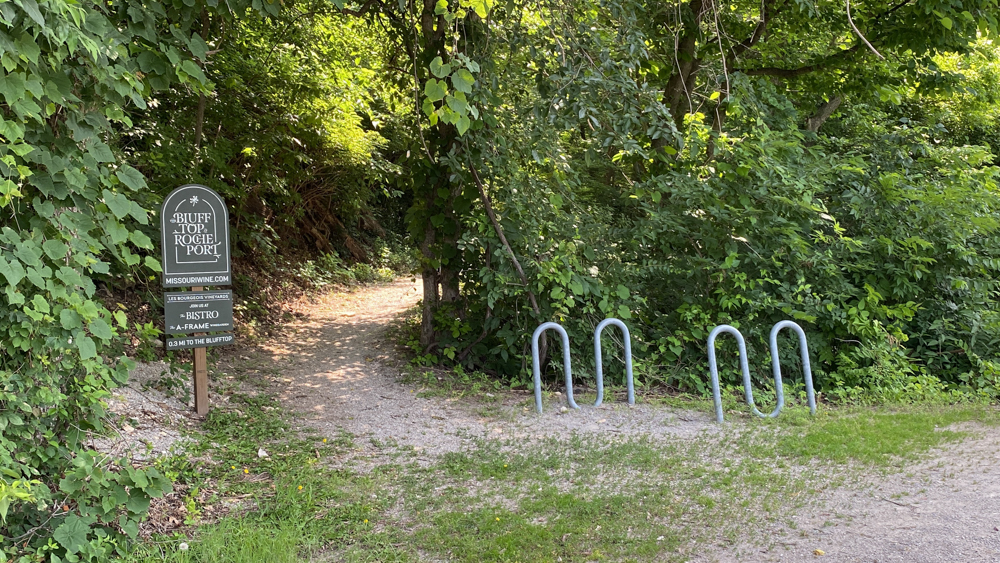
Next on the trail is a path to the Les Bourgeois Vineyards | The Blufftop at Rocheport, which we visited later in the day for dinner. You can leave your bikes here on the bike rake and hike up the bluff to visit the winery for a bit of a rest, drink, or filling up on a little bit of food.
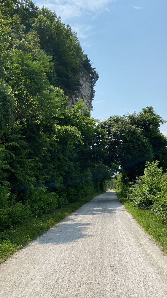
I loved this view with the tall bluff and the arching greenery over the road.
Highway 40 was under construction, so we had a special protective tunnel to travel through as we went under the Highway.
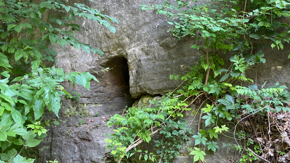
We stopped for this thinking it might be something we were looking for, but regardless it seems to me a miniature cave.
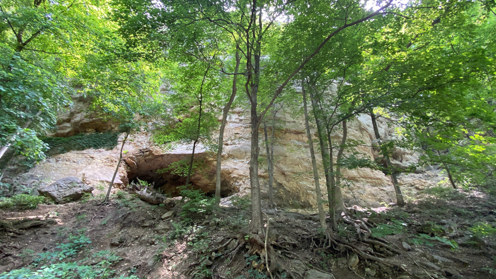
We thought this might be something too, especially since there was a bench to sit and look at it. We were struggling to find the pictographs (which I thought were petroglyph) by the Native Americans and thought they might be at several of these locations. I think the mileage we were looking at was off. I learned that pictographs are paintings on rock and petroglyphs are craved or engraved into the rocks. I had no idea there was a difference.
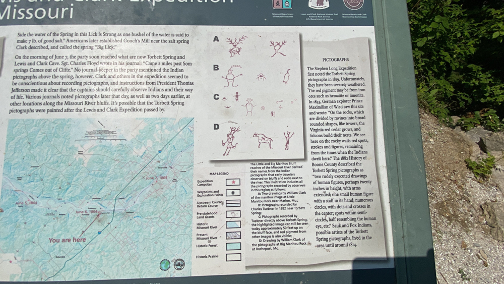
The Native America pictographs are at 174.4 (maybe). The are above and to the left of the Lewis and Clark Cave (as seen below). The sign says that the cave is on private property and not part of the Katy Trail State Park because the landowners wish to protect the cave from endangered bats. Facing the river across from the cave is an informational post showing photos of the pictographs that you can see, or was once seen, on the bluff. I was able to find two of them. Lewis and Clark camped below these bluff on June 6, 1804, which is across from the large Manitou Island which no longer exists. Lewis and Clark did not journal about these pictographs, although they did records others nearby (The "A" shown is by Clark is near Marion, Missouri, and the "D" shown is by Clark at Rocheport). It is thought that these pictographs might have been made after Lewis and Clark traveled through. An expedition by Stephen Long was the first to note these pictographs in 1819 at "Torbett Spring". The red pigment may be from iron ores such as hematite or limonite, and it has faded over the years. It is believed to be the artwork of the Sauk and Fox Indians that lived here until 1814.
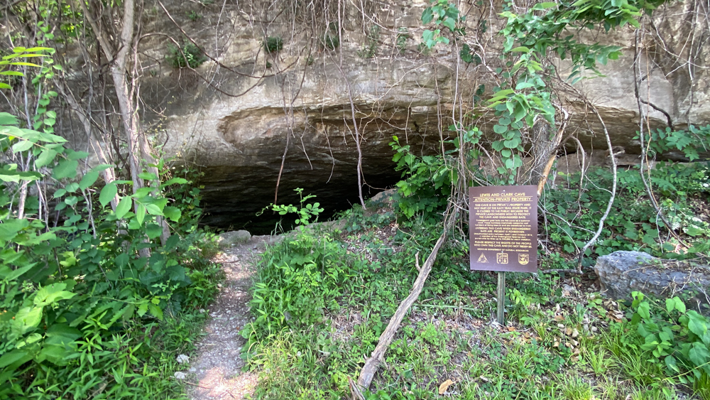
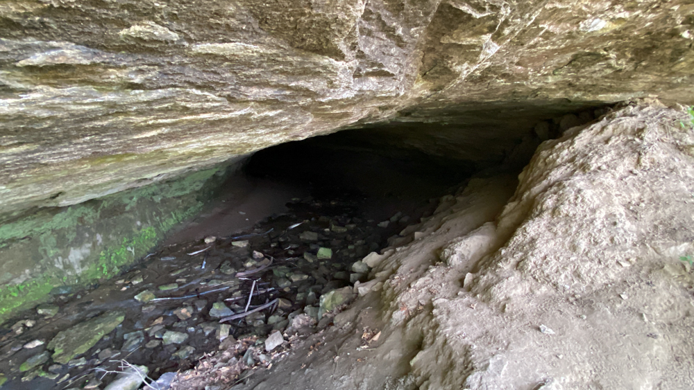 Above is a peak into the cave.
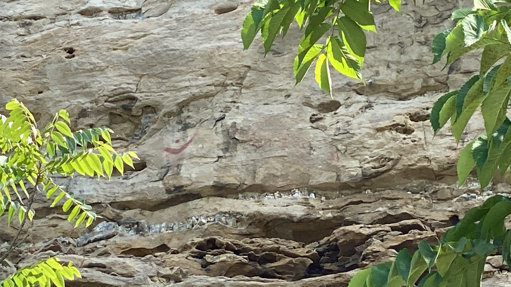
Above you can see the red ink.
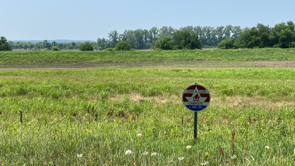
At 172.9 is a marker for the Lewis & Clark campsite for June 6, 1804. This is where we decided to turn around.
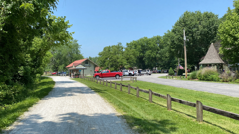
When we returned we put our bikes away at the AirBNB and drove back down to have lunch outside at the Merrwhether Cafe and enjoyed our time there. It certainly is a busy spot!