My Corner Online
Old Chain of Rocks Bridge and Amusement Park
Chain of Rocks Amusement Park
Chain of Rocks Amusement Park was located across and up the hill from the old Chain of Rocks Bridge. It no longer exists. It opened in 1927 and closed in 1978. The Park overlooks the Old Chain of Rocks Bridge. The Park was accessed via Riverview Drive to Spring Garden Drive then to 10733 Lookaway Drive. The park was located where current day Lookaway Court is now located. I have long wanted to visit the Chain of Rocks bridge because of the above video of my family at the park.
I have some photos of my Grandma and Granny at a picnic at the park as well.
Old Chain of Rocks Bridge
We visited the Old Chain of Rocks Bridge on August 12, 2023. I had taken my Aunt Mary's ashes to drop them off for burial and we wanted to make the most of our day.
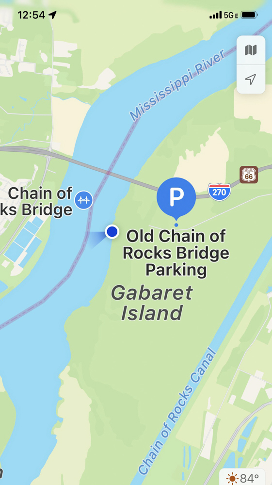
The park and that side of the bridge is barely inside St. Louis City, close to the border of St. Louis County. The Missouri side of the bridge is located at 10820 Riverview Dr, St. Louis, Missouri. It is said to be a dangerous place to be because of crime. We decided to visit from the Illinois side at the end of Chain of Rock Road on Chouteau Island in Madison County IL. It did seem a good distance to drive, but I believe that is because GPS took us the long way because the nearby bridge was under construction. It was much faster when we returned using the nearby bridge. We tried to drive by the Missouri side but the road was blocked because of construction, so I will have to try to stop there another time. The website did say we could park on the Missouri side, but not at the normal parking spot, but rather a 1.25 miles away. For this year, even if we were brave to visit with the crime rate, it was better for us to visit from the Illinois side.
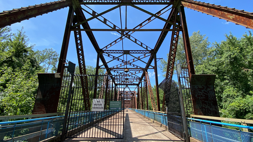
The National Park website warns not to leave things in the vehicle because of vandils which did intimidate me. There was a vehicle where we parked that seemed suspicious and the man was telling his child to get out of the vehicle to ride her bike, but he never took her out of her car seat and they never appeared on the bridge behind me. It seemed as if they were waiting for a target to hit, but in the end our vehicle was okay.
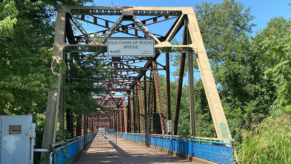
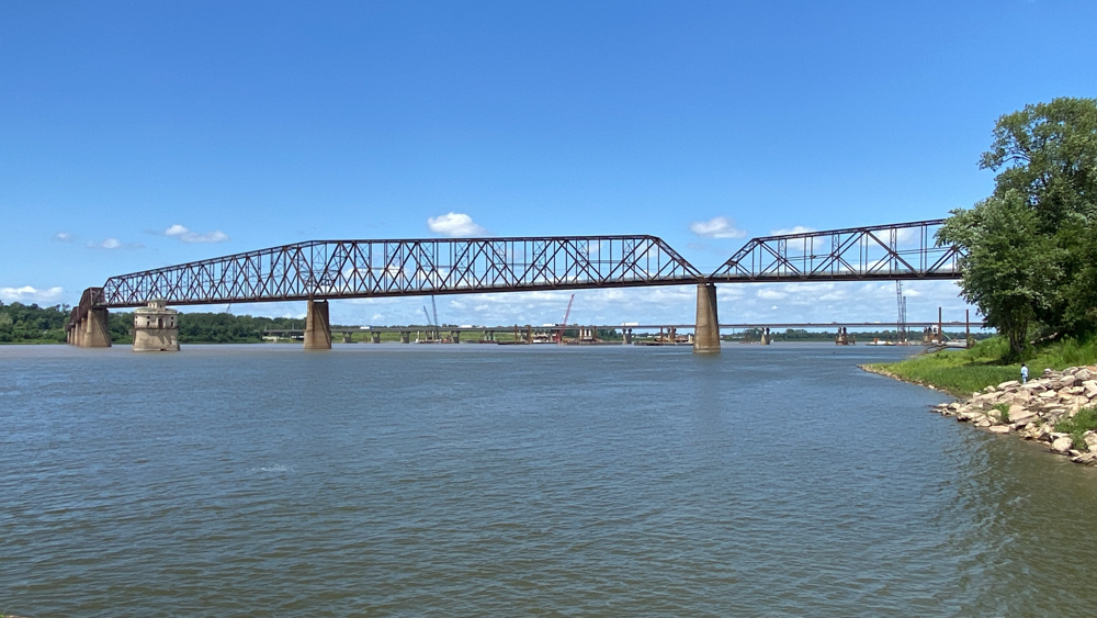
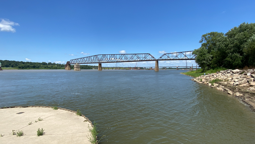
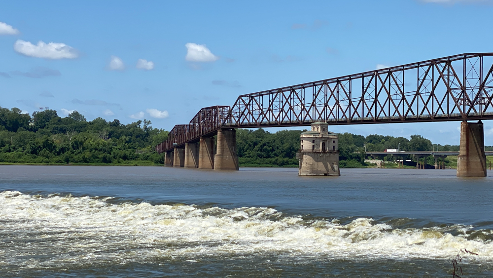
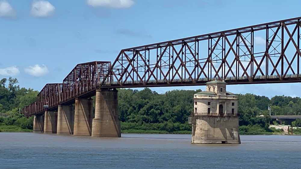
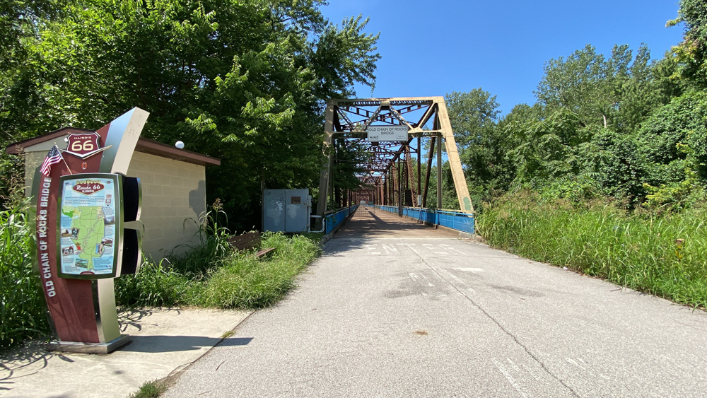
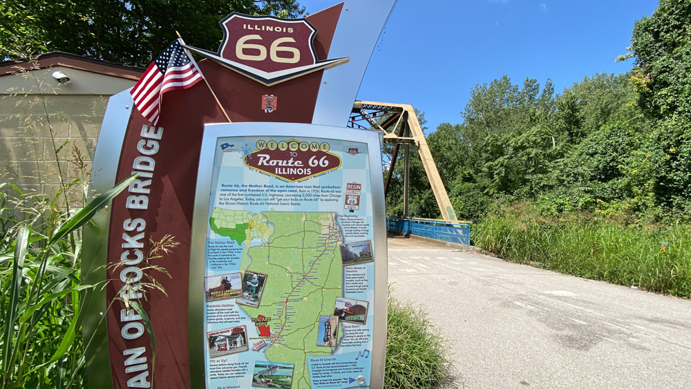
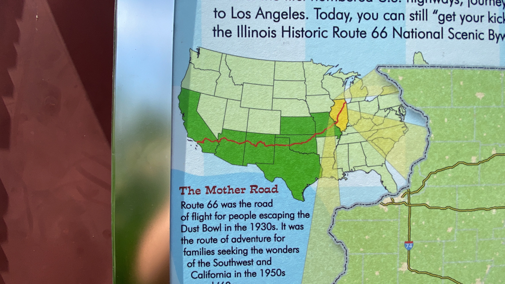
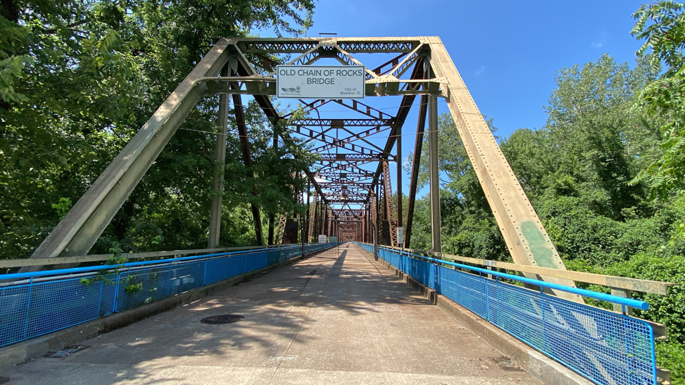
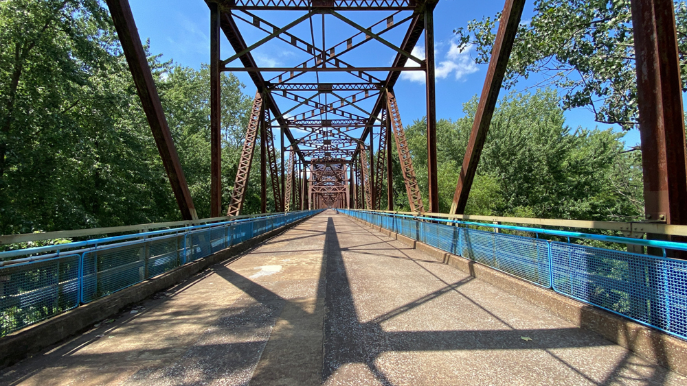
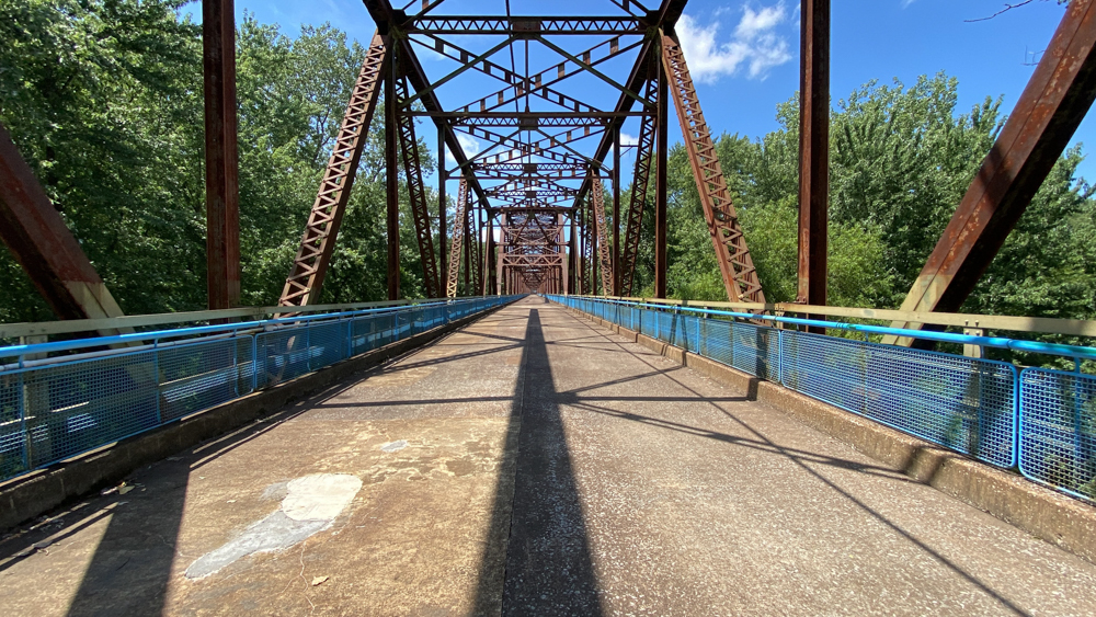
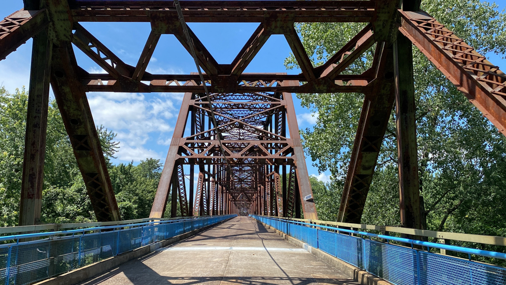
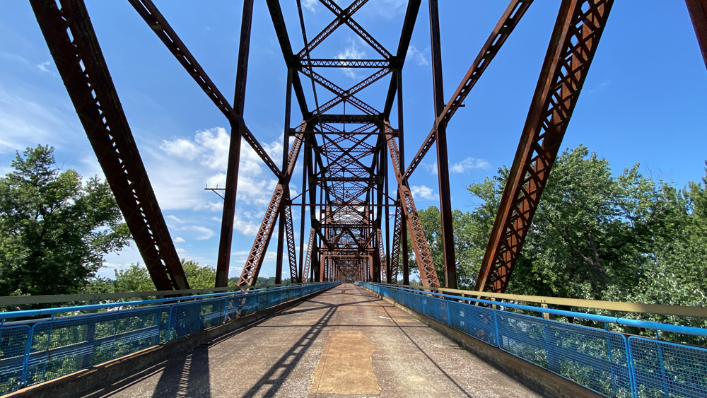
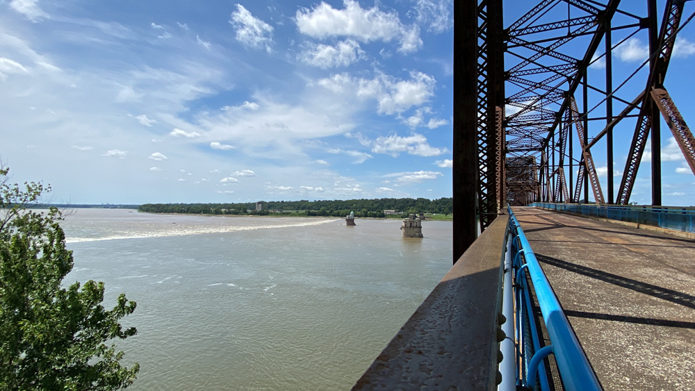
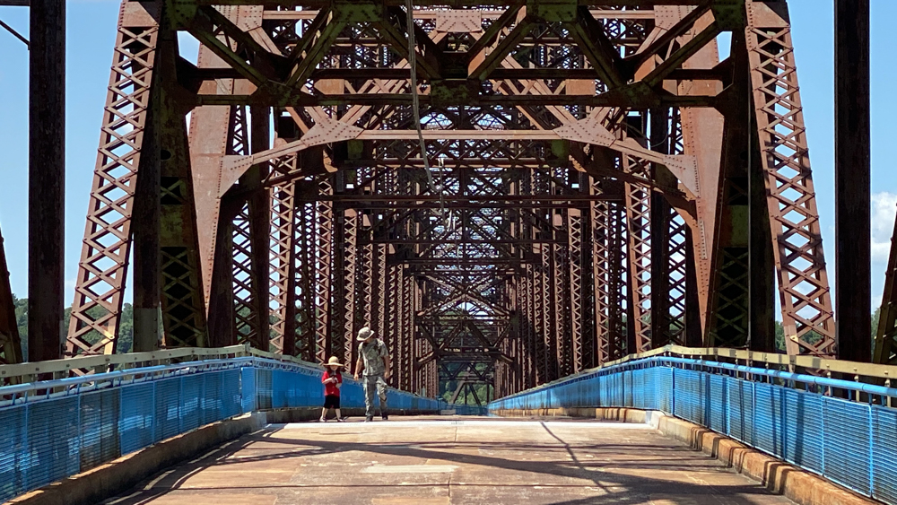
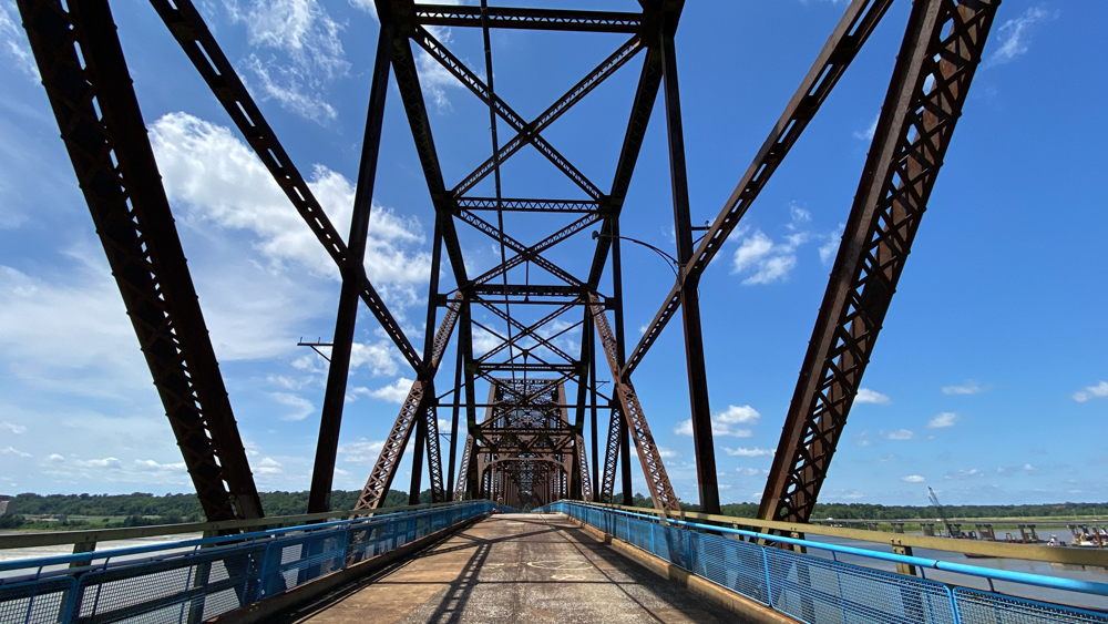
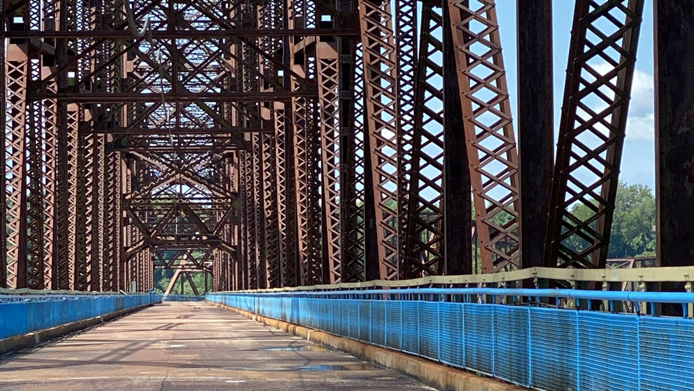
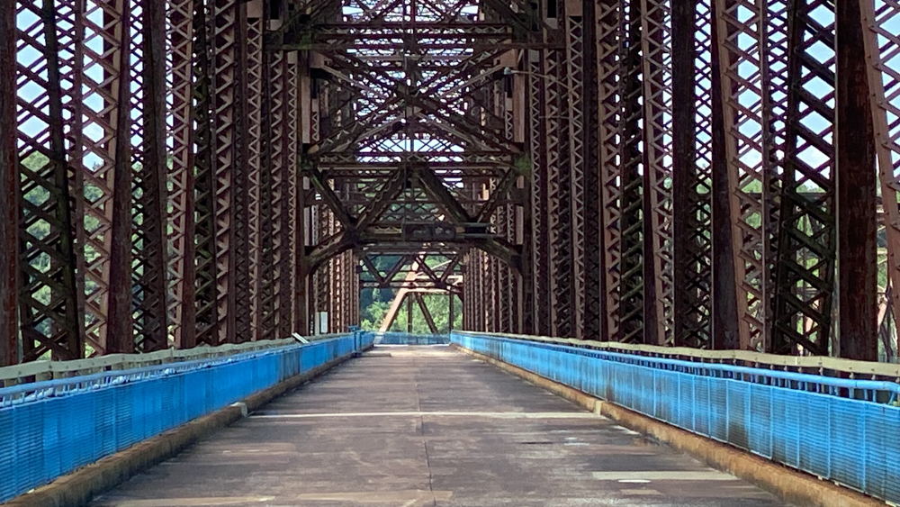
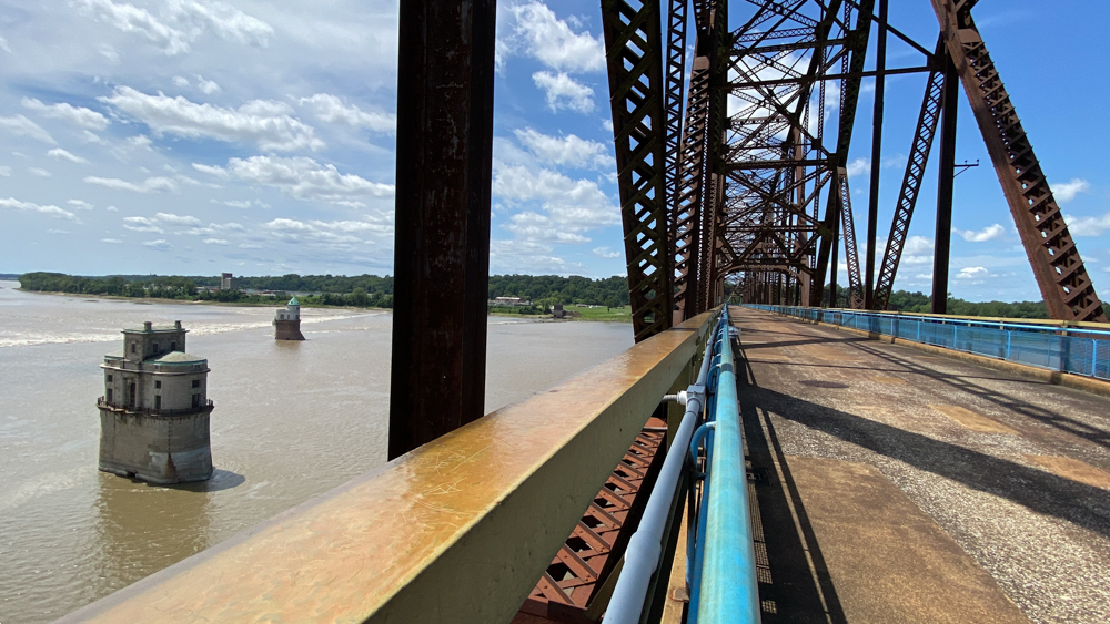
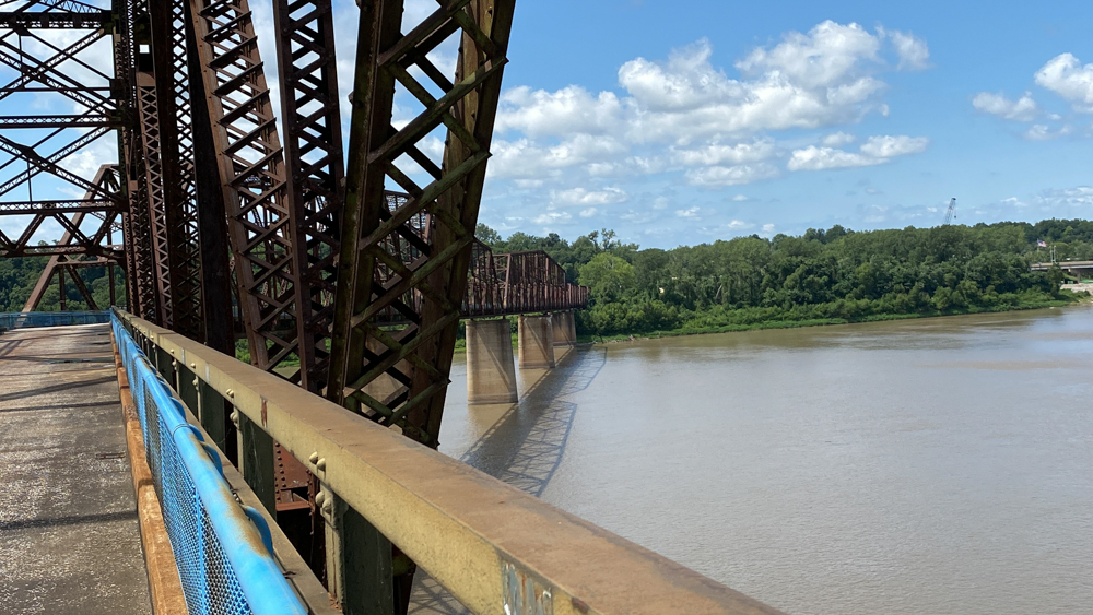
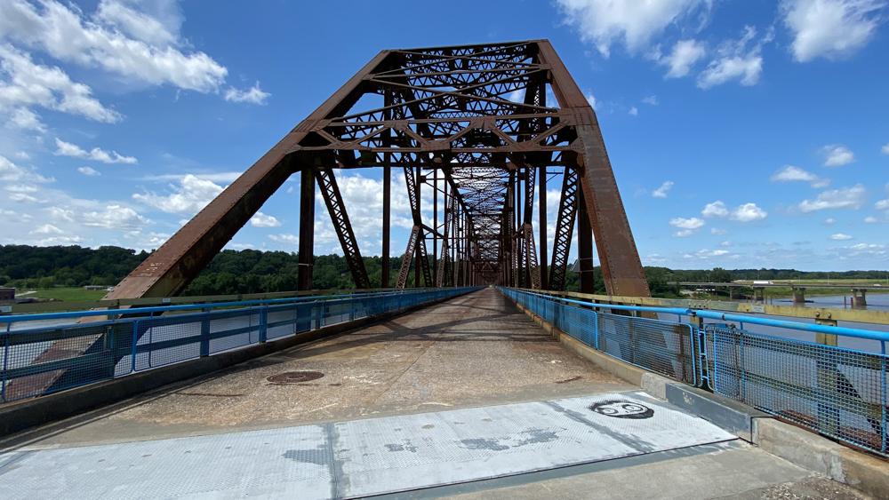
The Chain of Rocks bridge is part of the historic Route 66 crossing over the Mississippi River and is 1 mile long. A significant feature in the bridge is the 30 degree bend on two continuous spans. Curved bridges are rare, but this is even more rare because it is a single bend that changes the direction of the road rathr than a curve. When in use, as I imagined in the above video, drivers were faced with a seemingly ended road right over the middle of a huge river and were sure to slow down and take their time to make the turn, which was sure to cause traffic to back up.
We can imagine why the designer may have added a bend. First, the bend is near the two water pumping towers looking south of the bridge which may have helped boaters navigate through or around the pumping towers and piers. Another idea is that the bedrock of the river varied causing the piers to be built in more stable places.
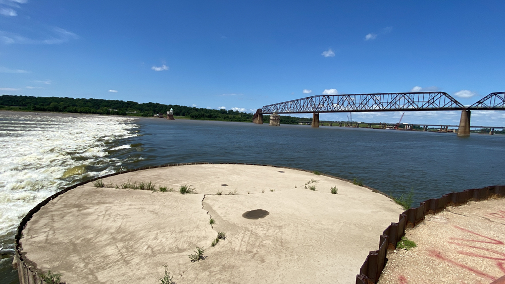
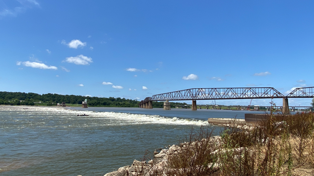
The Old Chain of Rocks Bridge was built in 1929 as a toll bridge, and there is a reason it is named "Old" because a new Chain of Rocks Bridge was built just north in 1966. This new bridge is the current Highway 270 and I did not realize it when filming, but this is the bridge that can be seen in the distance looking north. When the new bridge was built, the old was closed to traffic. It wasn't until 1999 when Trailnet made the bridge part of their trail system for pedestrians and bikes.
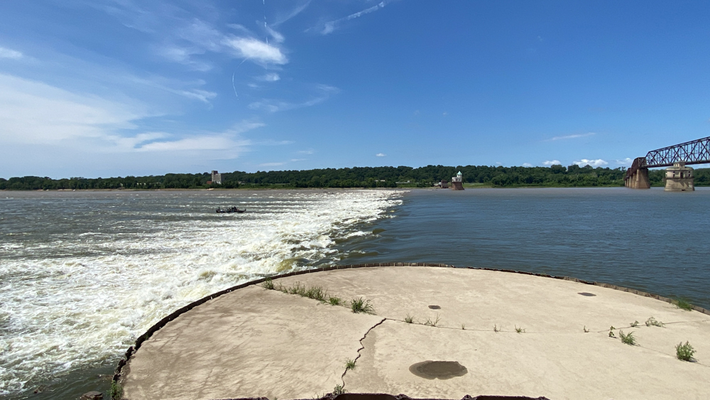
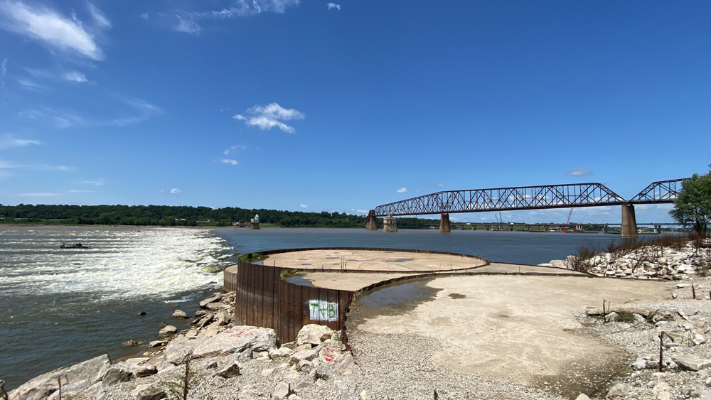
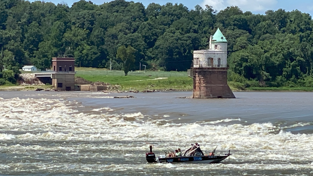
I should have done research before visiting and not after, but I have learned that the bridges are called "chain of rocks" because of a 17 mile stretch of rocky rapids that are too dangerous for vessels on the water. We were looking at a low-water dam the whole time and wondering about, that being the rapids of water going across the Mississippi River. The Corps of Engineers built the dam and now the water flows in such a way that we cannot see the chain of rocks.
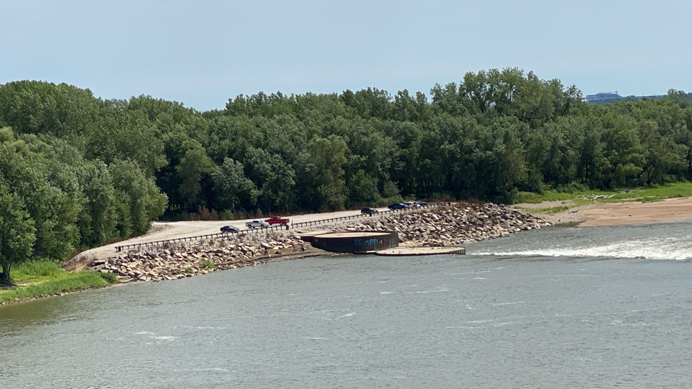
The one lane bridge across the Chain of Rocks Canal, which you can see at the end of the above video, allows river traffic to bypass the chain of rocks in the middle of the Mississippi River when the river is low. We talked several times about how we saw no barge traffic and how odd that felt to us.
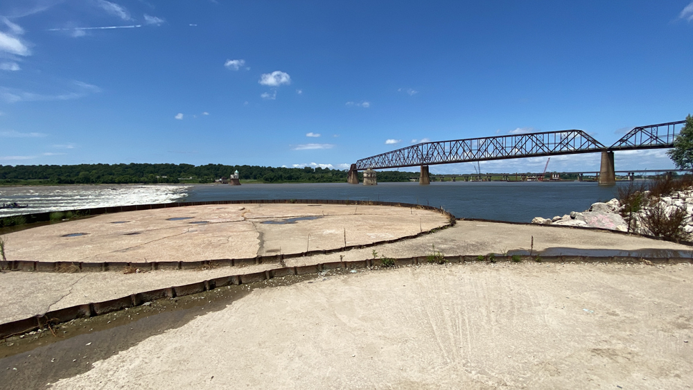
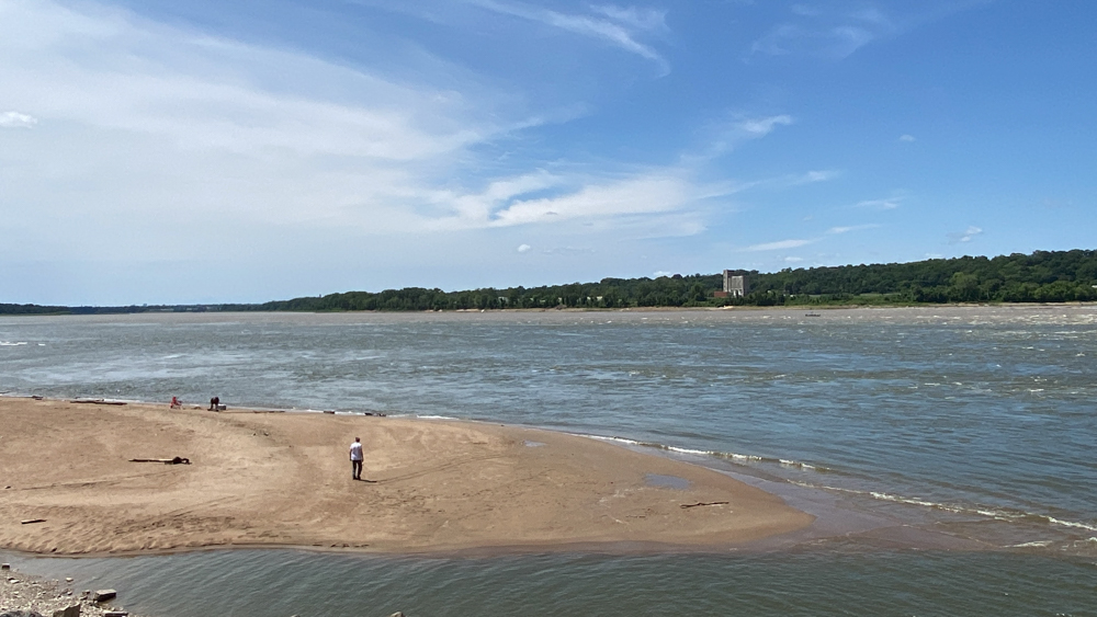
When we were almost at the parking area, we turned left down a road and arrived at this parking area, much to our delight. It was a great view of the river and of the dam over the Mississippi River with the rapids. We wondered what these pads were used for previously with their metal rings.
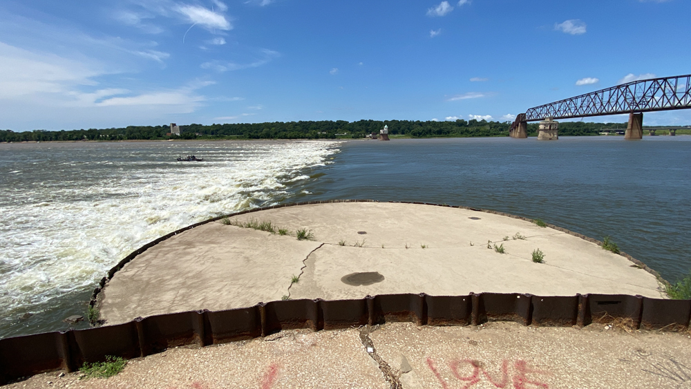
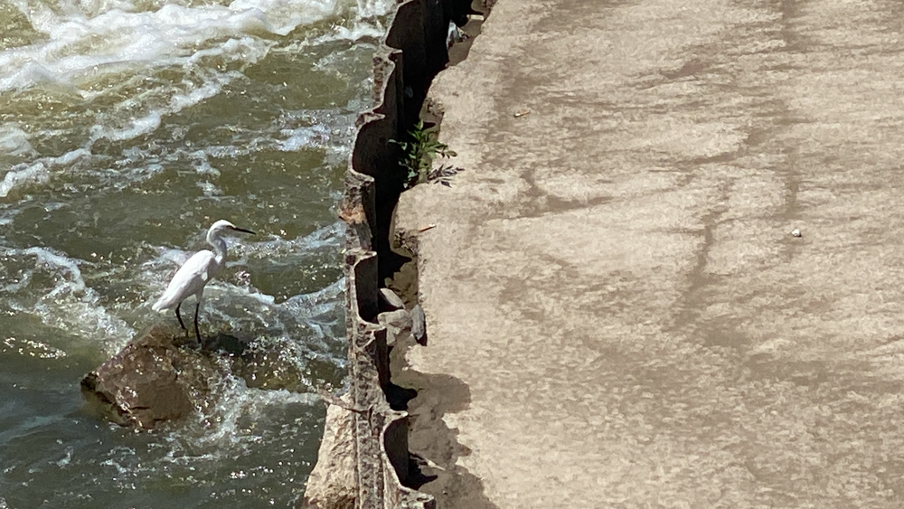
We absolutely loved that this crane was sitting on a rock and fishing in its own way, just like the boats out in the water, only taking the opportunity as the fish came around the edge of the concrete circle.
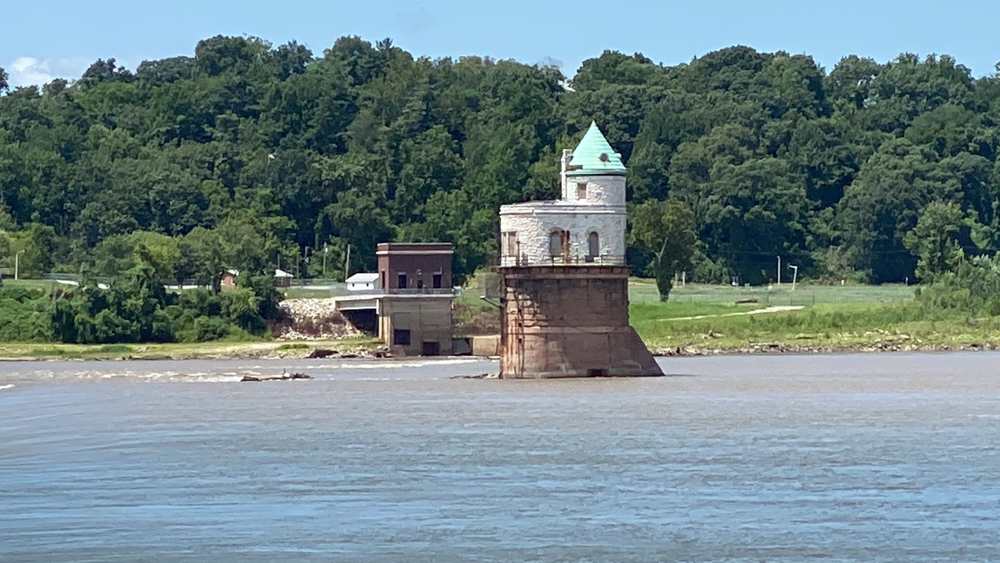
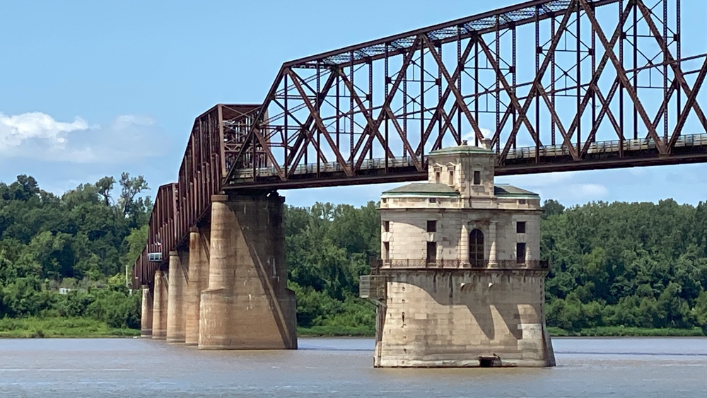
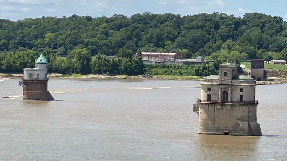
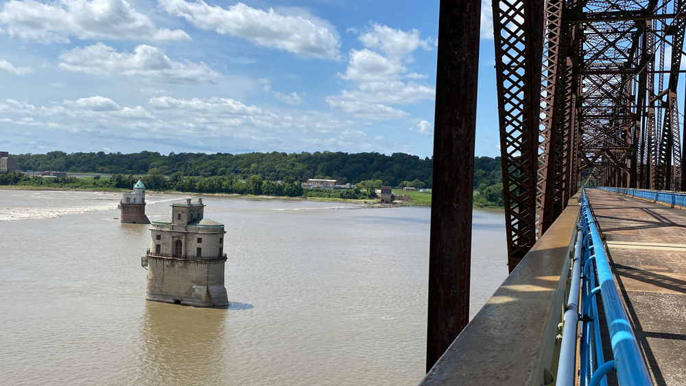
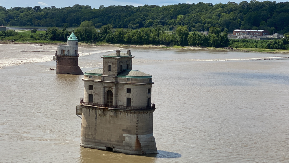
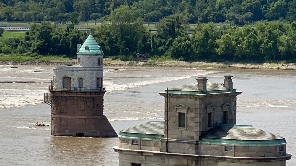
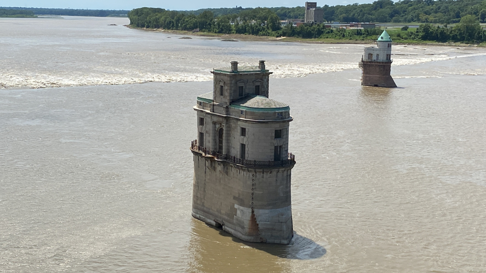
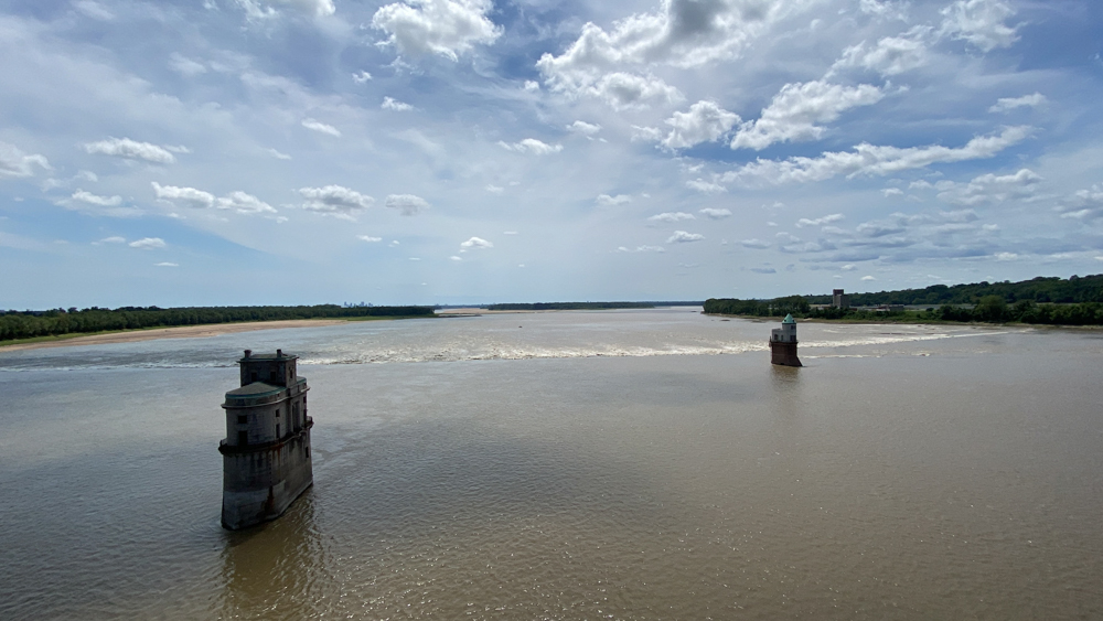
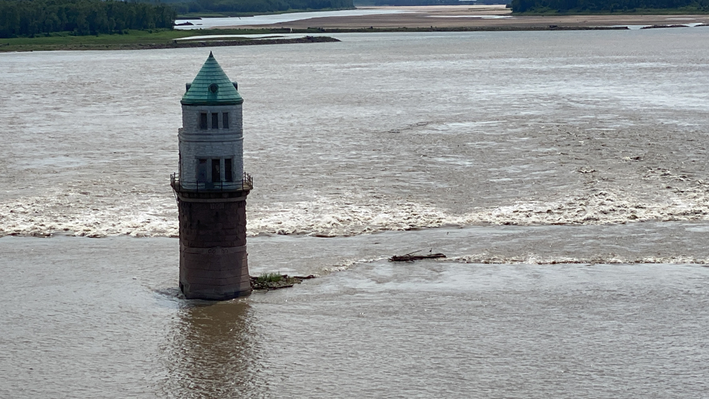
There are two intake towers in the middle of the Mississippi River which draw the attention of the eye everywhere you go. The mind imagines medieval castles and wants to know more. The two structures are water intake towers for the nearby St. Louis Water Plan. In the late 1800's St. Louis was experiencing a rapid population growth and needed to accomodate the people with water for daily use. The chain of rocks created a naturally low section of the Mississippi River, a rapid flow, and a quality of water, making it a good choice for the towers to be built. Water Tower No. 1 (above) was built in 1894 (or I read 1896 too) in a romanesque style. It is closer to the St. Louis shoreline. This water tower is still in use today. Water Tower No. 2 (below) was added in 1914 (or 1915) in a roman renaissance style and is used today as a backup. This tower is closer to the bridge and further out in the water. This water tower has an area to house workers around the clock.
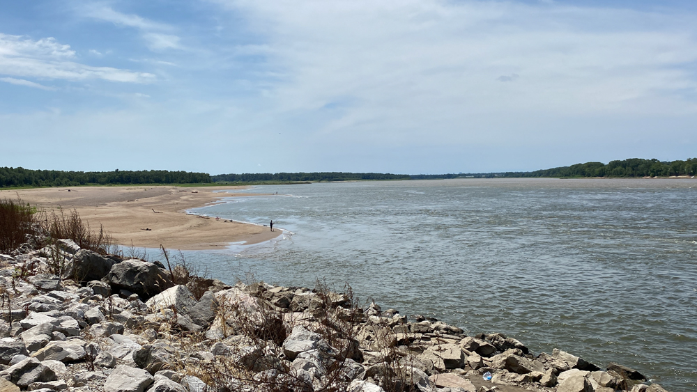
Looking north there is a beach that you can walk down to and utilize an opportunity to fish.
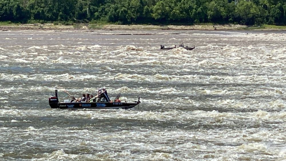
There were several boats in the choppy water which we presume were fishing. This sure was an interesting sight as if they were fighting against the current and yet so calm at the same time.
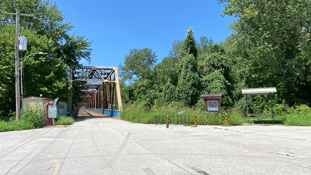
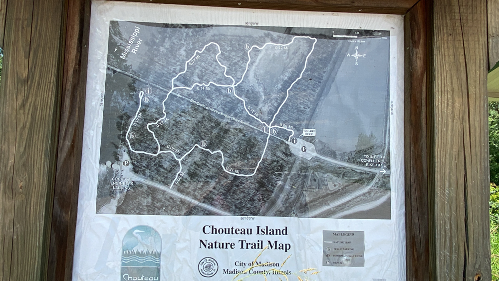
This is the entrance to the bridge from the Madison County, Illinois side. Off to the right is access to the walking trails.
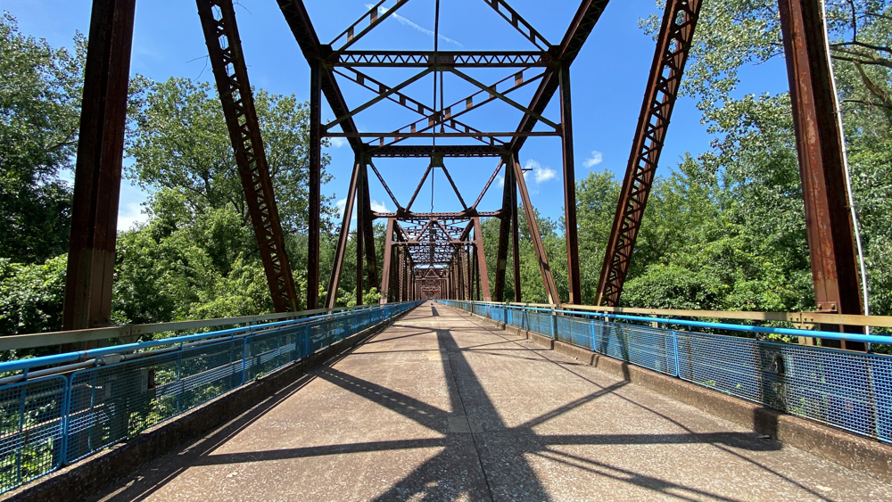
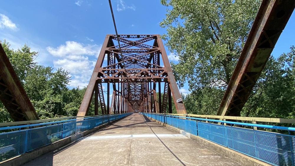
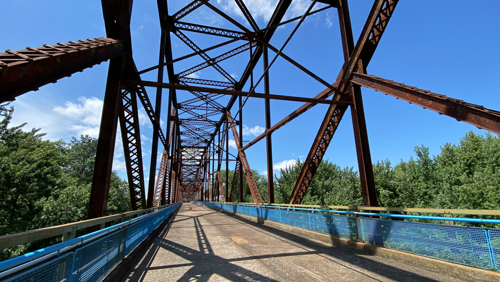
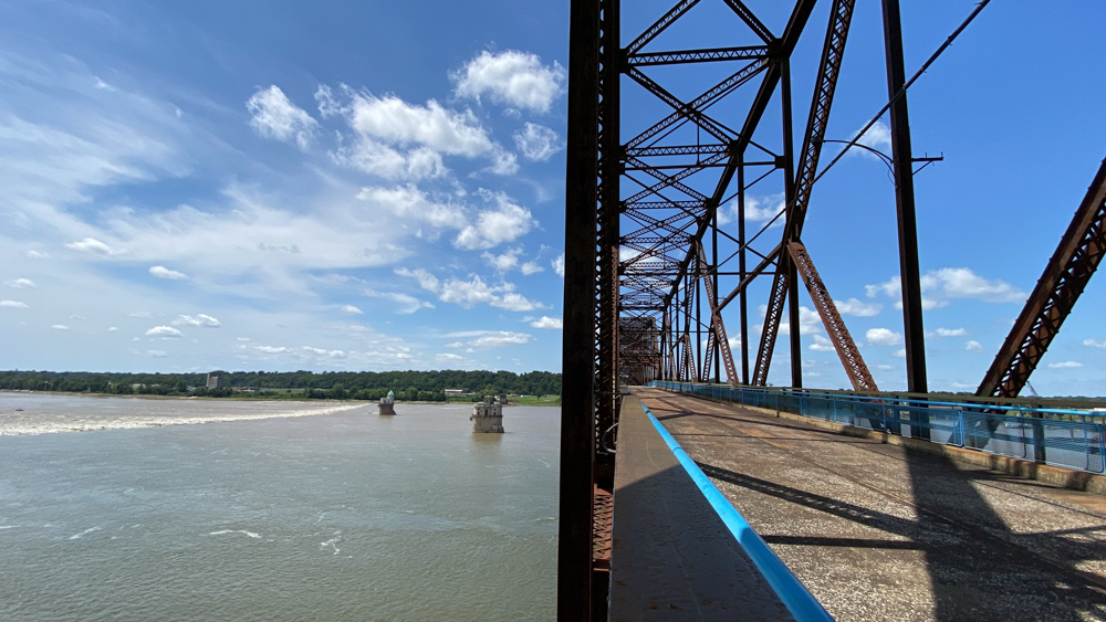
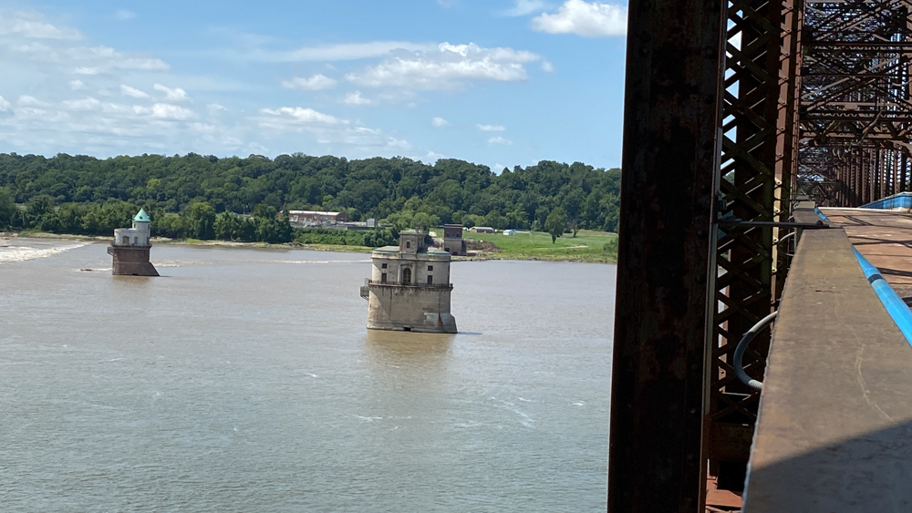
I loved how as I walked along the bridge the perspective of the intake water towers changed, including their perspective and positioning to each other. There are many photographic opportunities here and no two photos seem they would be alike.

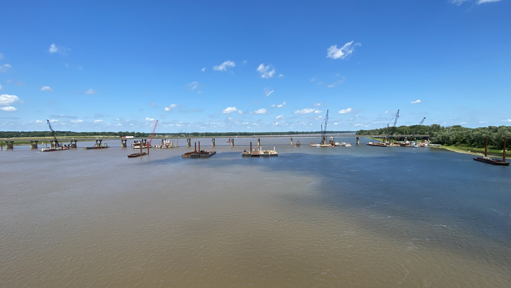
This is a view of the new Chain of Rocks Bridge that now carries folks on Highway 270. All of the cranes are for the construction happening on the bridge.
This is a look back at the parking lot where we took the first photos.
This is a look of the bend and the section that enters onto the Missouri side of the river. We did not go this far, but wanted to.
This is the famous 30 degree bend in the bridge!
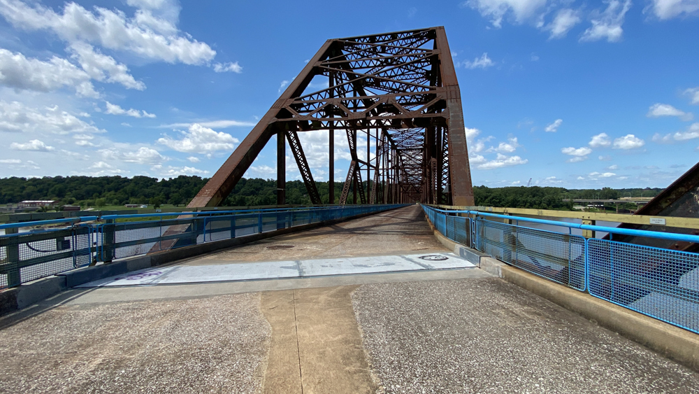
This is where the traffic would get bottlenecked back in the day.
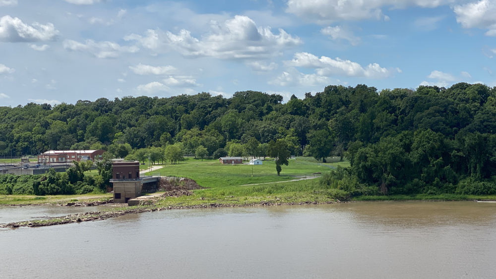
This photo is important to me because I was told that the Chain of Rocks Amusement Park was formerly up on the hill where there is a gap there in the trees. Across from the building with the white roof is a set of stairs that takes you up the hill.